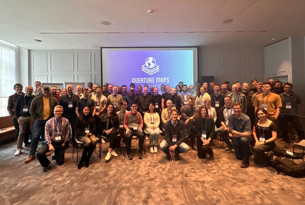
It was an honor to participate in the first Overture Maps Foundation Member Summit in Ghent, Belgium. MundoGeo, the leading magazine in the geotechnology field in Latin America, published an interesting article on the topic. I hereby share its English translation.
Thierry Jean, one of the founders of the Brazilian AddressForAll Institute, is currently in Ghent, Belgium, to participate in the three-day meeting of Overture Maps.
Launched with initial support from Microsoft, Amazon, Meta, and TomTom, the project has already attracted over 25 sponsor members.
Founded in 2022 under the Joint Development Foundation, Overture is dedicated to the development of reliable, easy-to-use, and interoperable open map data that will power current and next-generation map products. Overture builds this data through a collaborative process that combines technology, data, and support from a wide range of companies. Launched with initial support from Microsoft, Amazon, Meta, and TomTom, the project has already garnered over 25 sponsoring members. It offers four themes of geospatial data: Transportation, Places, 3D buildings, and administrative boundaries. Additionally, a group has been formed to explore the publication of addresses, which is why the AddressForAll Institute, a Brazilian NGO specialized in searching addresses databases in Latin America, was invited to participate.
When asked about Overture Maps’ goals, Marc Prioleau, executive director, responded: “Overture’s focus is on the application developer who uses map and spatial data to build applications, do spatial analysis or any other operations that need a open shared spatial framework. Those users want the data to be best in class, leveraging all available sources of open data, checked and validated for quality and delivered in a format that is easy to use and allows other data to be attached to the basemaps. Overture’s goal is to build that as open data, allowing contributions from many sources and leveraging the resources from a wide partner base to build the best map. We are able to leverage the work from OpenStreetMap which has been building open map data for two decades and supplement that with other compatible open source data. We also are developing an open entity reference system that allows all kinds of spatial data to be attached to those baselayers, creating a rich ecosystem for map developers.
Thierry explains: “About 40 people were expected for the first edition of this meeting. 75 attended, from all over the world, allowing for a rare concentration of talent. Marc highlighted 3 points in his opening presentation: ‘This is the right time, This is hard, We have the team’.” Certainly, the Overture Maps project needs to be closely monitored and could represent a significant change in the landscape of global geospatial data.
#OvertureInGhent

Addresses for Development: National Address Infrastructure and AFA Codes Technology in Peru

Thierry intervenes in the World Statistics Congress in The Hague (Netherlands)

What We Learned in Our Webinar on Unique and Open Address Database Projects in Countries!
Delivering the BANOC Codes: A Landmark for Open Addressing in Cameroun


Hey how's it going?
Can you write your comments here?